

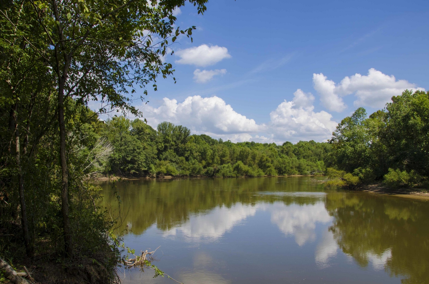
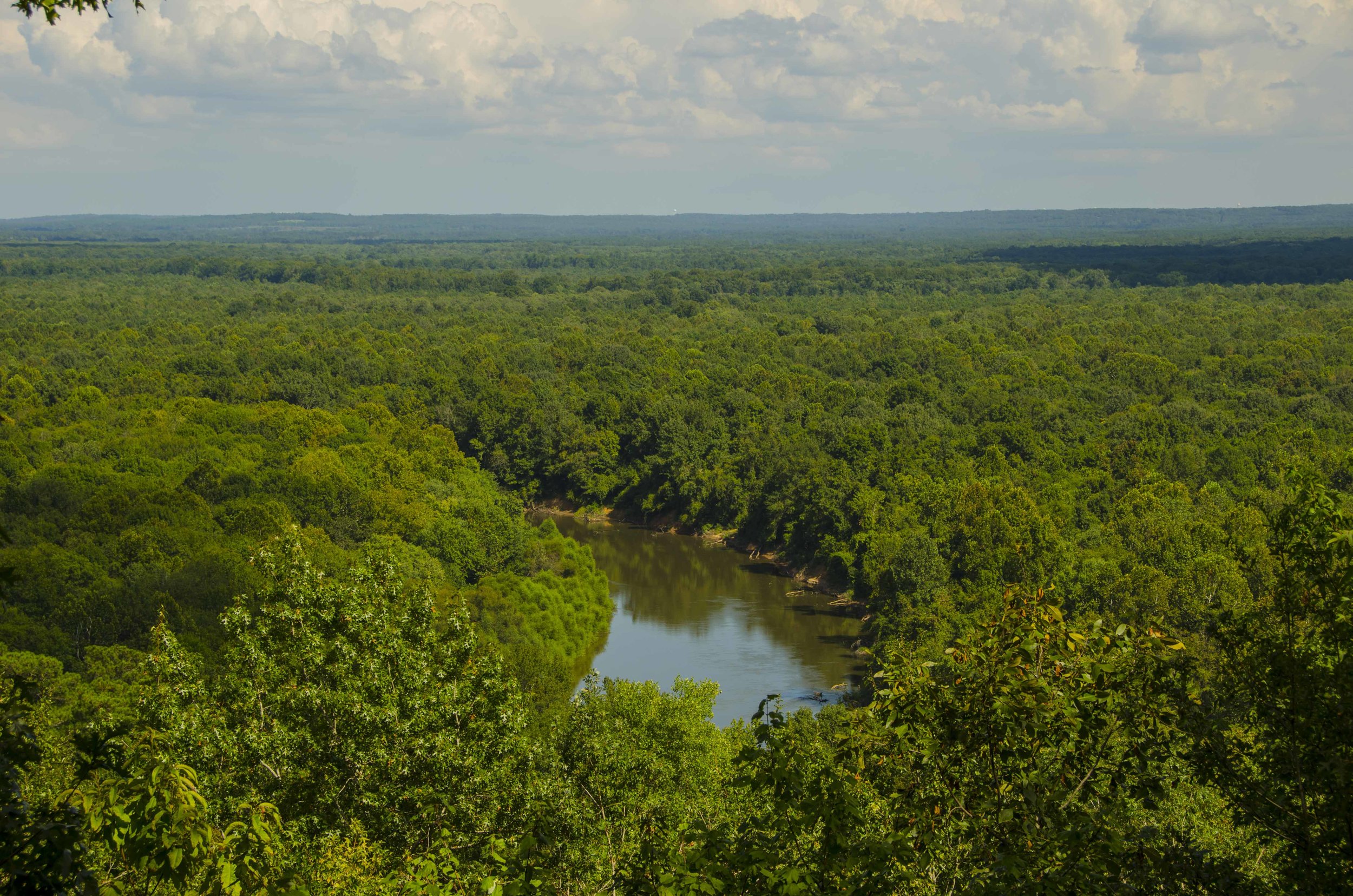
The Wateree River forms the Western boundary of the Heritage Preserve and WMA, providing good fishing opportunities for those willing to make the hike down to the water’s edge.
According to the SCDNR public lands website, Wateree River Heritage Preserve and Wildlife Management Area is comprised of the old Cook’s Mountain and Goodwill Plantation tracts. It is an important property due to both its historic and natural resource characteristics. You can still find graves, ditches and dikes built by enslaved Africans for rice production on the preserve, and land types range from a beautiful hardwood forest along the river to some of the highest elevations in the central part of the state. “Cooke’s Mountain” itself rises to an elevation of 372 feet above sea level, an anomaly in this area that offers scenic views for miles. The mountain was the home of Mr. James Cook, a famous cartographer, who produced the Cook Map of South Carolina in 1773.
That’s what the website says.
“This is kind of like “Proud Mary,” is what I’m thinking to myself as the transmission drops down into 2nd gear headed up the steep, winding road into the property off of the Sumter Highway (U.S. 378) just a short drive from the outskirts of Columbia (the Ike & Tina version, not the Creedence version). Which is to say, you could have it easy, or you could have it rough, on a trip to this place. Looking at all these great roads, I’ve got mountain biking on my mind, and I’ve got a few friends who would find the challenge of bearing down in the pedals on the steep climb up Goodwill Plantation road invigorating, challenging and fun.
Yeah…. those guys are nuts.
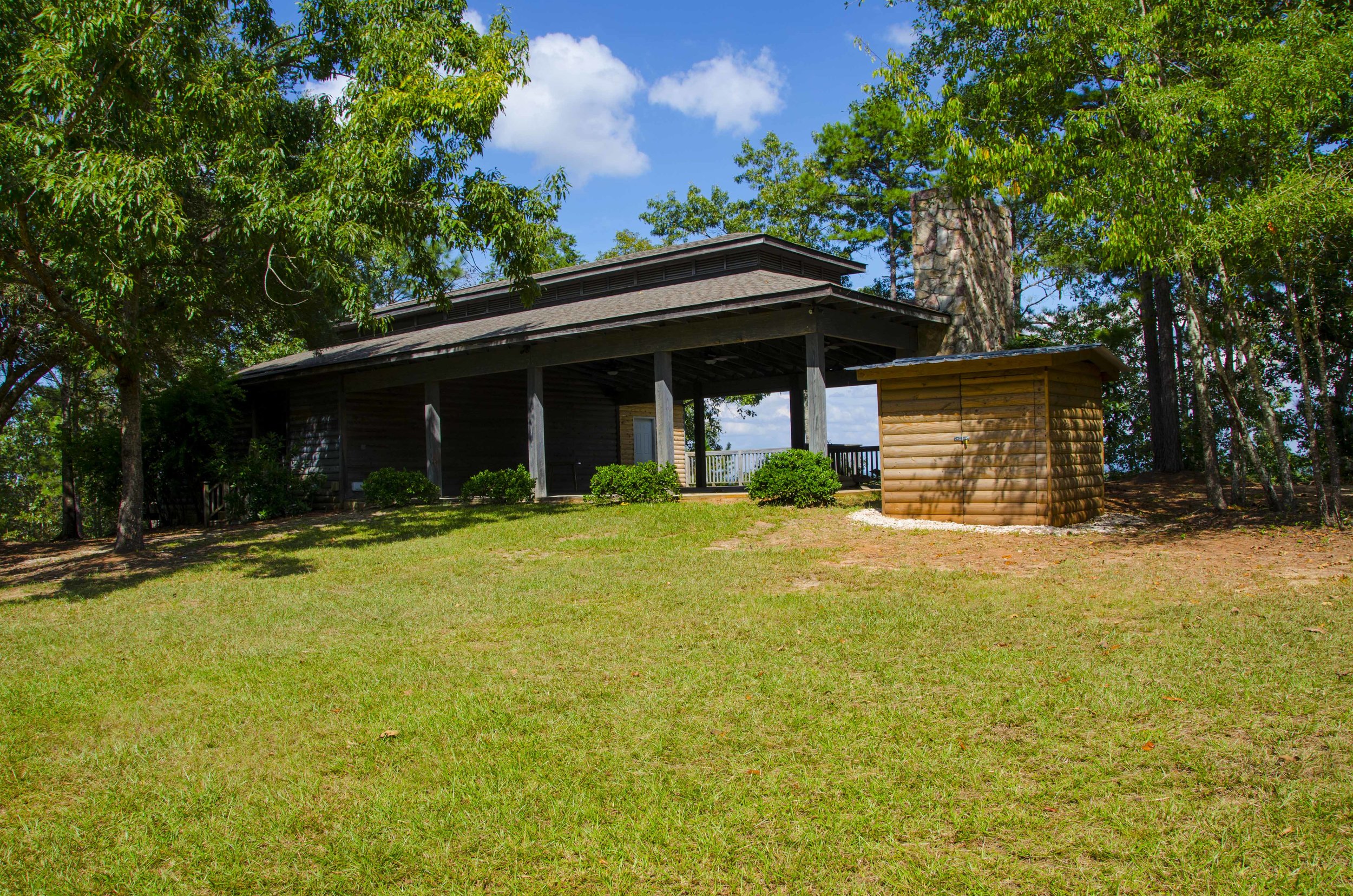
Me? I’m A) glad to be making the trek up the mountain to check out the highest point in the preserve and the beautiful outdoor classroom there (and a stellar view of the Wateree River), in “Old Blue,” the former SCDNR game warden car that is my dusty yet trusty travelling companion for these blog assignments. And B) thinking that the thing to do on a mountain biking trip here would be to bring two vehicles and portage, like the paddling folks do it. Leave one vehicle down at the kiosk near the highway, drive up to the top and take a nice, long leisurely pedal from the top to the bottom – maybe exploring a few of the interesting-sounding side paths along the way (Turnip Patch trail anyone?) Awesome! (And easy, my couch-dwelling brethren).
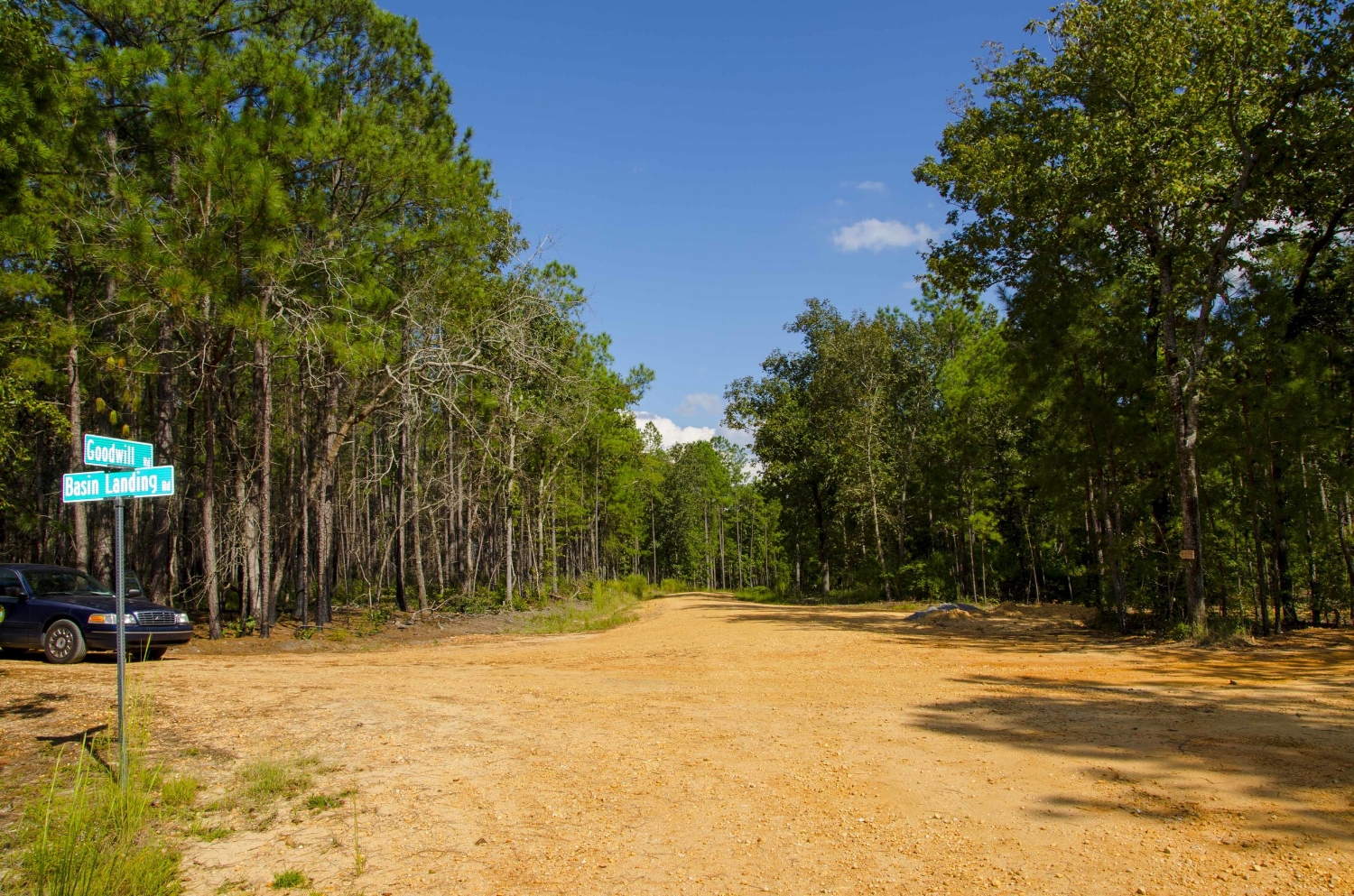
“Old Blue” at the intersection of Goodwill and Basin Landing roads. I can just see myself making a leisurely downhill pedal here.
That’s the thing about Wateree – your outdoor experience here can be as intense, or as leisurely, as you’d like. There are just so many options.
Take fishing, which is what property manager Travis Bennett and I are discussing while we walk along the banks of the muddy brown Wateree River, scoping out what could be the future location of some primitive camping spots, depending on how the final management plan for the property (one of the newest SCDNR Heritage Preserves) shakes out. The process for gathering public input for the final plan for the property is still ongoing, but so far, public input has shown huge amounts of interest in paddling, camping, and even horseback riding, in addition to fishing, hunting, hiking, nature viewing and, of course – mountain biking. Each activity comes with its own set of challenges for SCDNR managers, who have to balance the wants of the public with the challenges of protecting the property in perpetuity, not the least of which is operating in an environmentally sensitive floodplain, which describes the portion of Wateree HP along the Wateree River. Per the terms of its ownership agreement, the SCDNR MUST protect the property and complete wetlands protection and enhancement projects as the first objective.
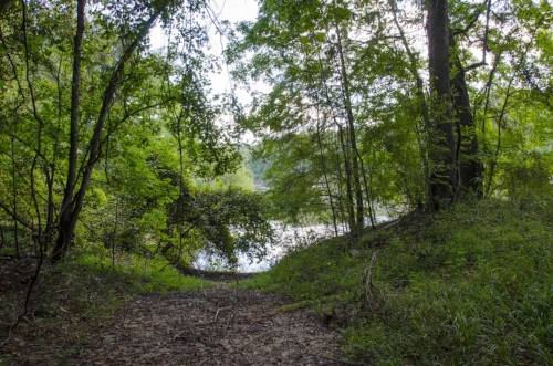
The steep, narrow trail down to the river’s edge does a good job of illustrating one of the two sides of Wateree that I’ve been pondering. Folks who don’t mind (or maybe even prefer) their fishing adventures with a side of hiking, and who don’t mind the fairly steep riverbank, could find a lot of fun in parking at the locked gate at the top of the dirt path that leads down to the river and hiking in for a somewhat remote fishing adventure – walking the edge of the overgrown bank and casting for bass or bream.
This spot along the riverbank, where the property’s previous owners created a primitive boat thrown-in spot, could become a camp site at some point in the future.

This fishing pond at Wateree HP has proven to be hugely popular with local anglers.
On the other hand, the property also features a spring-fed pond that offers bank fishing opportunities in a very relaxed setting, just a short downhill walk from a designated parking area. On the day I visit, a single fisherman is trying his luck near the pond dam. If you do come to fish the pond, please be cognizant of other people that will be visiting after you and only take as many fish as you can enjoy. Also, no littering regulations are strictly enforced, and be aware of alligators, which mean no unleashed dogs or unsupervised children near the ponds edge, both of which should be common sense measures in any outdoor setting anyway.
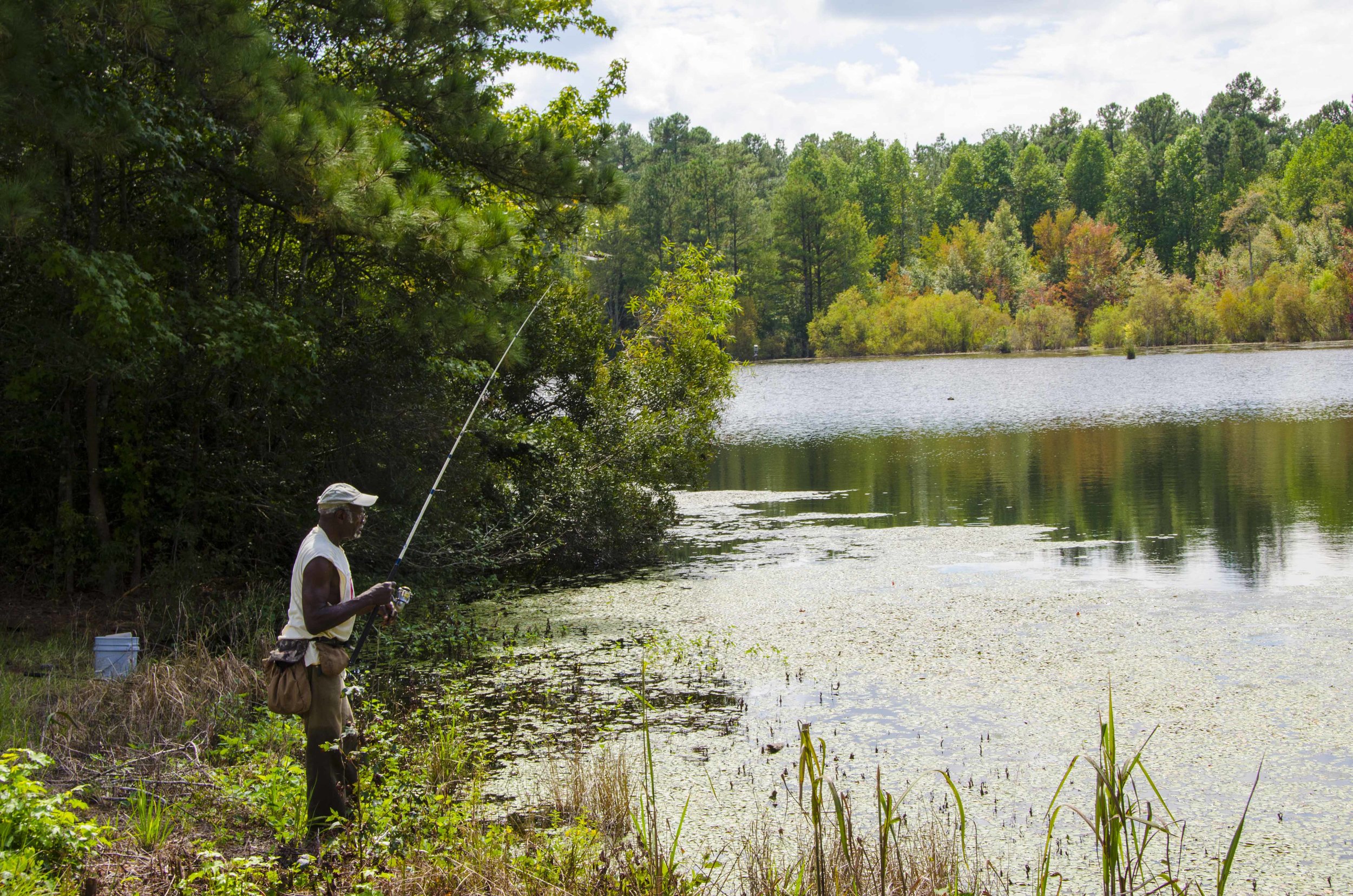
On a recent warm fall day, this man trying his luck at the pond said he’d had at least one bite in the short time that he’d been there.
“Another low-impact option – picnicking, like near the old home spot on Overlook road, where steamboats carrying passengers and supplies once called on Goodwill Plantation, is proving to be a popular option,” says Bennett. On the day we visit, there’s folks enjoying the view from near the old home site while sharing a picnic lunc.
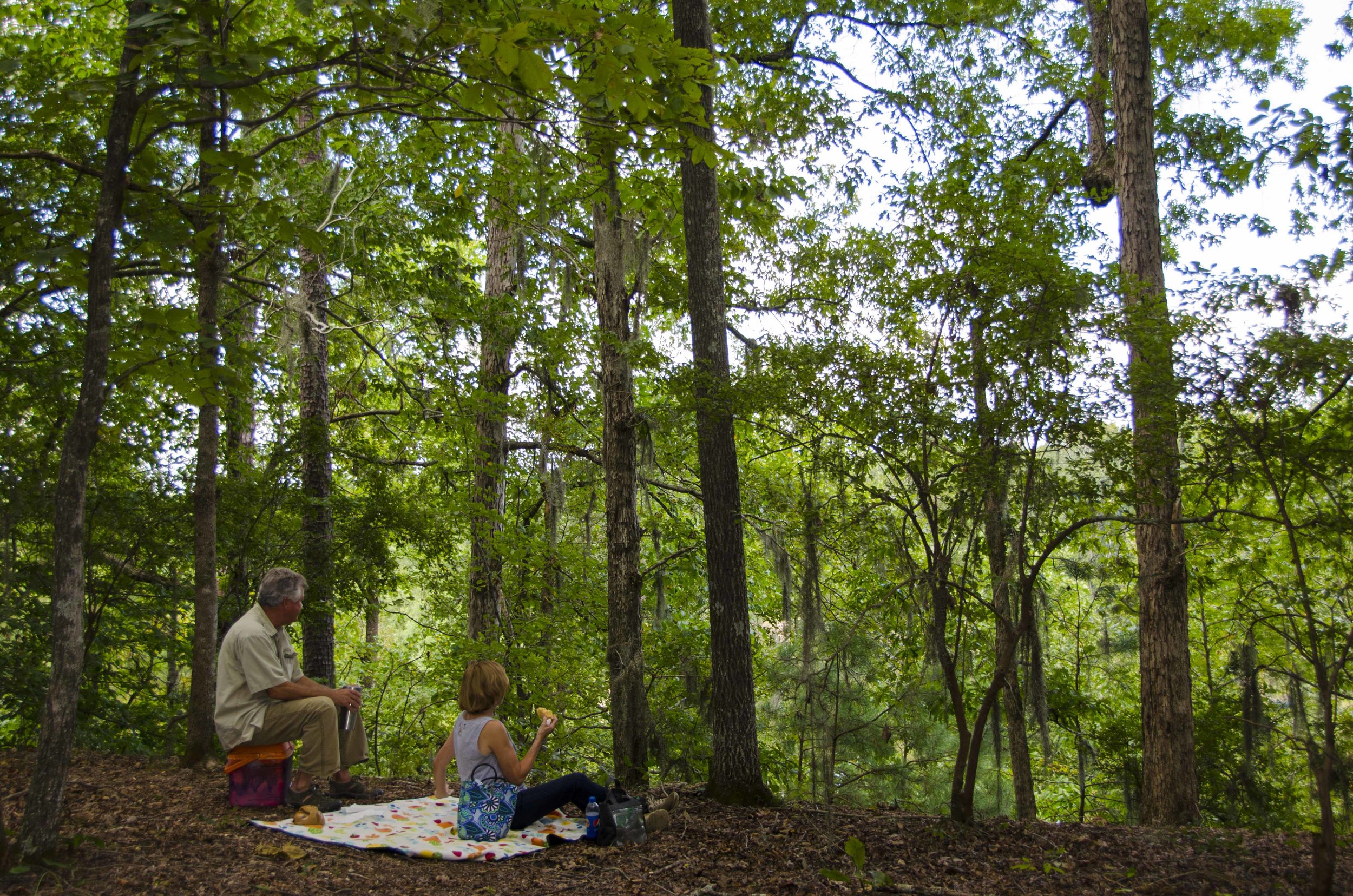
These folks were enjoying a picnic lunch and the view from the end of Overlook Road, where steamboats once tied up to bring goods and passengers to a bustling Goodwill Plantation.
Hunting opportunities on the property will include drawn hunts for deer and hogs, as well as scheduled dates for turkey, waterfowl and small game hunting. The non-hunting public can visit the property during daylight hours year round EXCEPT during scheduled hunts (see website for hunt days).
Tours or opportunities to use the outdoor classroom at the top of the mountain for meetings will also be available to school or other groups by appointment. This past spring, for instance, the COWASEE Basin Focus Area Partners held a workshop on migratory songbirds and bird-friendly forest management and conservation easements. The seminar included classroom presentations at the education center, lunch, and field trips into the property to see demonstrations of the management strategies discussed in the class.
It’s an amazing property with a wide range of uses that is sure to be “wildly” popular with the citizens of the populous areas nearby seeking to get out and enjoy nature. I’m already thinking about a late winter trip to hike some or the trails and single track roads in search of rabbits or squirrels for the purlough pot, or maybe we’ll do that biking trip, or spend the day walking the riverbank in search of catfish holes . . . at Wateree River, the options for outdoor fun and adventure are wide open.

In addition to the main roads in and out of the property, a large number of side roads and firebreaks provide lots of accessible places to explore at Wateree River HP & WMA.
