

By Alana Overbey, SCDNR Archeology Intern
Contemporary archaeologists employ new methods of finding and surveying archaeological sites, including the use of LiDAR (Light Detection and Ranging). LiDAR is a remote sensing method using light in the form of a laser to generate precise, three-dimensional information about the surface characteristics of the Earth. However, modern archaeologists may find themselves in a race with nature.
The interconnected effects of sea level rise, water temperatures, ocean acidification, and extreme weather events impact archaeologists’ work. Thousands of known archaeological sites in the Southeastern United States, many of which are eligible for the National Register of Historic Places (NRHP), are at risk of disappearing due to these changes. As such, archaeologists work to use LiDAR and other imaging directed to find sites quickly, informed with predictive modeling based on the distributions of known sites. It is currently estimated that there are six to seven times more unrecorded sites than recorded sites, suggesting that many cultural heritage sites and the materials they hold are at risk of loss.
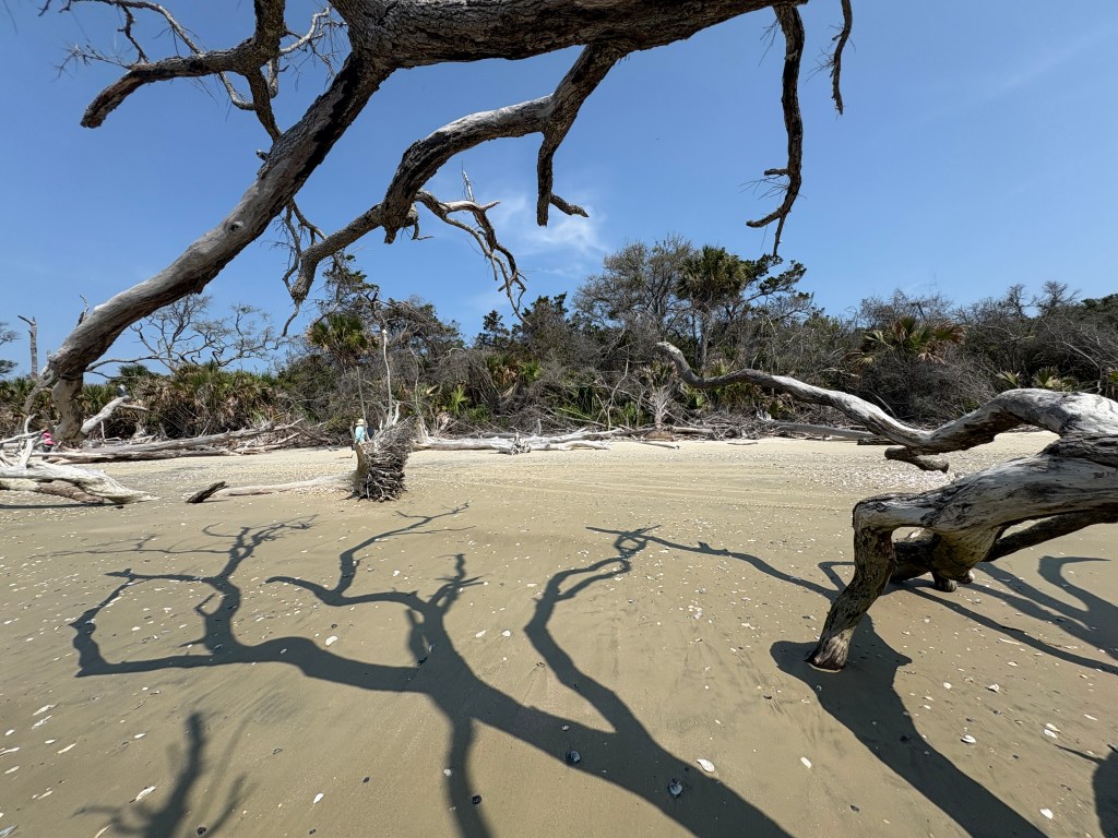
One of the sites identified in recent years with this technology is the 4,300-year-old Indigenous site of the Pockoy Island Shell Ring Complex located at Botany Bay Heritage Preserve on Edisto Island, SC. Botany Bay Heritage Preserve is one of the largest remaining undeveloped wetland environments along the Atlantic Coast, important to many wildlife species and cultural resource sites including the shell rings, plantation outbuildings, and more. This site has been heavily impacted by erosion, requiring regular, systematic erosion monitoring efforts.
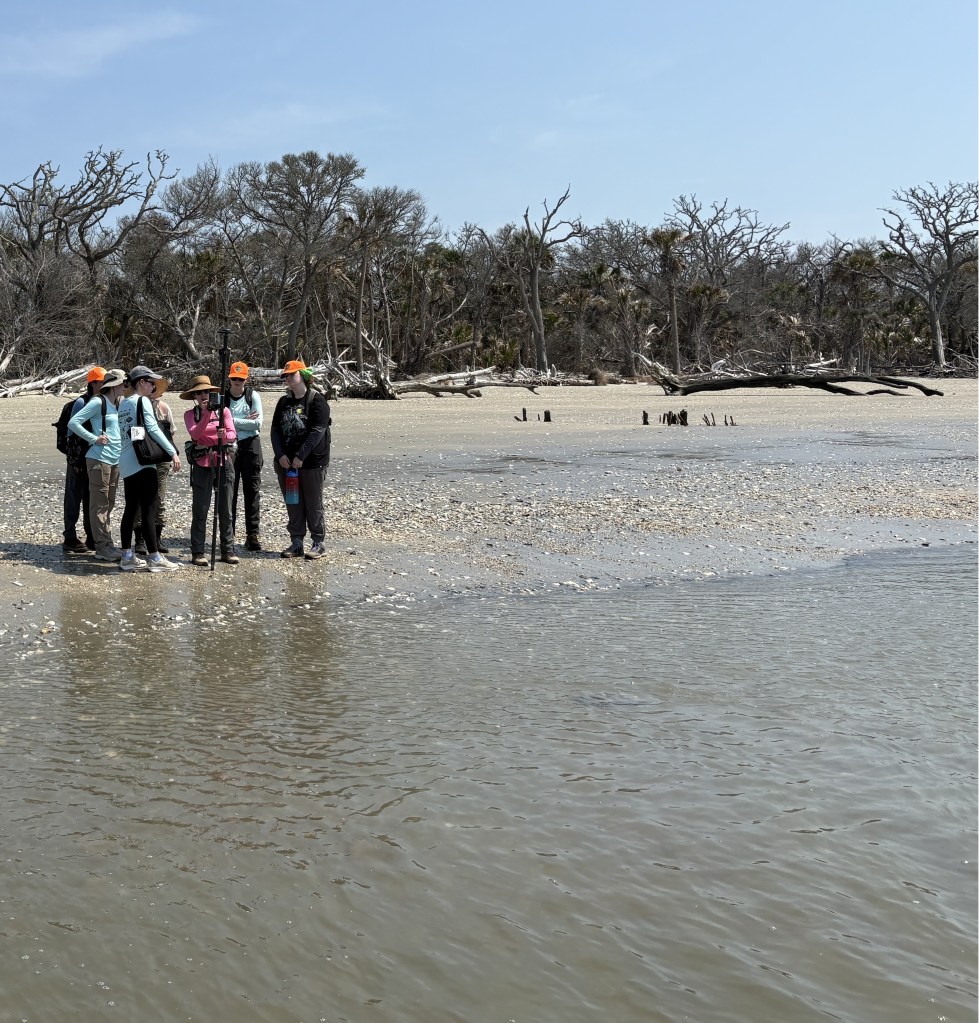
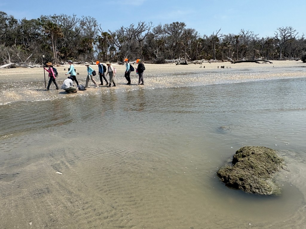
As one of the SCDNR Archaeology interns, I was able to visit Pockoy and help gather these measurements with the SCDNR Archaeology team in collaboration with SCDNR Coastal Geologist Katie Luciano. We collected shoreline erosion measurements using two methods – an Arrow Gold RTK and on-the-ground transects. With this work, it was important for us to collect accurate data and stay consistent with our measurements to effectively calculate and measure the rate of erosion at Pockoy. The work was part of a larger effort to augment our understanding of the shoreline erosion processes. Volunteers frequently participate in monitoring the site, especially after hurricanes and high tide or King Tide events.
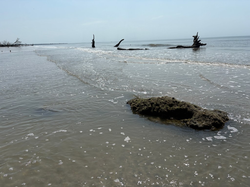
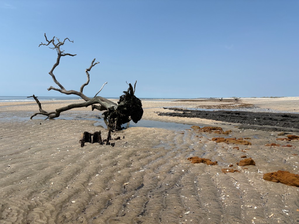
Storms and high tides can undercut the shoreline, which along with saltwater intrusion, contributes to destabilizing the soil matrix and root systems. These effects cause the trees to fall and erode the shoreline, converting the maritime forest into a beach environment. While on the island, we saw the few remains of the first shell ring, which had already been eroded and destroyed by the water. We could see a small portion of the original site at low tide, but it was clear that the rest of the shell ring was gone, unable to be studied in its original context.
The second ring of the two-ring complex is expected to disappear within two years based on the island’s erosion trends. SCDNR Archaeologists have been working to account for this problem by conducting emergency excavations of the shell ring complex to study as much as possible before it is too late. However, these excavations are still under threat from flooding, which can remove artifacts from their contexts, making it harder to gain a more comprehensive understanding of the site. The entire island will soon be gone, making it critical to learn as much as we can about Pockoy Island while it is still possible.
As we enter hurricane season, it is important to recognize how tropical storms can have far reaching impacts beyond what we normally think of. Even storms that do not pass directly over the site can still have an impact as heavy rains and storm surge increase water levels, exposing archaeological sites and materials to further erosion processes. Water action and winds can bury artifacts under sediment but can also destroy and fragment the site in more extreme events.
Pockoy and other sites, both known and unknown, are at risk of being lost. Thus, it is critical for archaeologists to engage with local and descendant communities to act as servants of the past, telling the stories that people want to hear. Likewise, we can all engage in “citizen science” volunteer programs to help archaeologists with their work, including erosion monitoring efforts. Diverse groups of people can participate in archaeological work, raising awareness of the existence of sites and their significance, cementing their historical and cultural legacy.

Leave a comment